
Day 18: Sisters, OR
Journal for 2016-09-29 | Published on 2016-10-02 08:16:14Day 18: Sisters, OR
It was a nice quiet night in the campground and we got on to the road with a cool 45F air temp. Today was our climb up the North Santiam River and then on to the Santiam Pass. We rode along with reasonable shoulders for most of the way with the river on the side and pine trees everywhere else. It is amazing how many trees there are here, and they are very pretty, but they also hide a lot of the views. So most of our day is spent staring at a road line with tall pine trees.
We went through a bit of road construction and had a few folks cheer us on from their cars. We paused pretty much anytime there was a break in the trees to observe all things not pine trees. Finally we joined Highway 20, which is the only major highway to cross the Cascades in Oregon. Traffic was steady, the road generally consists of two lanes in the upward directions plus a rideable shoulder for us.
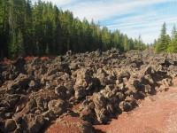
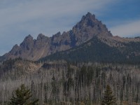
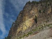
Finally we started to get some views, but unfortunately it was due to the B&B complex fire which occurred in 2003 and still defines a large part of the Santiam Pass landscape. With many thin tall dead trees it allows you to get views of the valleys and the pass itself. Going along the pass we paused on a corner that no cars could pause and snapped a picture of the tall granite faces towering over the roadway.
Eventually we made our way to the PCT crossing where we paused for lunch on a knocked over tree and enjoyed the various mountains we could view including, 3 Fingered Jack, Mt. Washington, and a few of the “Sisters.” Then it was back to the road and the well earned descent from our peak of 4800+ feet. Along the way down we paused for various overlooks, one about the B&B fire, one above Suttle Lake. Then in was back down in to the pine forests of Highway 20.
Traffic was definitely picking up, Pam thinks it might be because hunting season is about to open, there were a lot of RVs on the road for a Thursday. We dawdled for a bit deciding if we should just grind the highway all the way into Sisters, or follow our pre-planned ACA route which took us off the highway. We decided to take the ACA route and were rewarded with some nice vistas of the Sisters we likely would not have gotten from the Highway. We also were rewarded with our first completely wrong set of directions, that put us 3 miles outside of town. A bummer way to end the day grinding 3 miles back to town with a stiff headwind.
We pulled in to the city “Creekside” campground and found they have hiker/biker sites and free hot showers, basically paradise after days of forest service campgrounds with minimal to no services. Showers, a jaunt into town for some pizza, and then a sad attempt at groceries. We got back to camp and decided on a plan for the next couple days.
Our legs are pretty tired from the hills, the next stretch of the route is 93 miles without services, and the weather calls for potential rain / snow showers on Sunday. In light of all these factors we are going to take a short ride (29 miles or so) and then settle in for a couple days. We will strike out again on Monday well rested and it will align our stopping points much better for our ascent to Crater Lake, which should happen on Wednesday.
Time: 5:11:20
Distance: 51.64 (Total: 808.39miles)
Average: 9.9
Climb: 3543ft (Total: 47,191ft)
Max:34.4
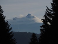
Clouds hugging the mountain tops
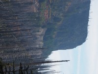
look, not pine trees!
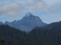
Three Fingered Jack
A portion of Santiam Pass, you can see the road up at the bottom
Three Fingered Jack
Pausing at the bend of the road, this was towering above u
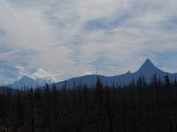
Mt. Washington and the sisters in the background
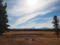
The Sisters on our way into town
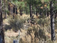
Deer watching us watching you.
0 guestbook posts. Click here to post one.