
Day 27: Ashland, OR.
Journal for 2016-10-08 | Published on 2016-10-08 20:32:21Woke up this morning to a beautiful sunrise over Willow Lake. The air was crisp, but it wasn’t as cold as it has been the last few mornings. Sunrise keeps coming later, and later, and since we don’t ride in the dark, we are getting ready a little bit later every day. We didn’t have a hot breakfast to prepare this morning, as the little grocery store didn’t have what we wanted, so we ate danishes and poptarts and dried fruit. Even though we had less to clean up, we took a while to get packed up. The tent was a bit wet from condensation, so it seems like even if it doesn’t rain, we can’t keep a dry tent.
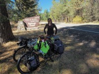
We rode the 1.5 miles back to our route, and then started the climb. It was a good pull, with a few small steep sections, and with the sun shining, it was pleasant. We stopped at around 8 miles up to snack, and at that point we only had 4 miles to the highway. At one point, a forest ranger slowed down to check on us and make sure we were ok as we were riding. Definitely appreciated, but not necessary.
We were riding through the forest today, and the scent of the pines was almost overwhelming! The air was so fresh and nice, it just felt clean.
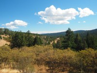
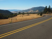
We briefly turned on highway 140, and then it was back to another forest service road to get us to Dead Indian Memorial Highway, which we would take into Ashland. We climbed, a bit and dropped a bit, then repeated, it got warmer. We had lunch at the Rogue River Forest boundary, and then continued the climb to the summit and it was straight up warm. Pam even shed all outer layers, and rode in shorts and shirt for the first time in weeks. For half the ride on Dead Indian Memorial hwy, there was no shoulder, and then magically a shoulder appeared at Howard Prarie Lake. We got one last look at Mount McLoughlin, and then that was it. We rode up and over the unnamed summit and were met with signs warning of steep grades and sharp curves for the next 9 miles. They weren’t kidding. We had fun riding down, but had to slow on the curves and sometimes bail off so cars could pass us. We were overtaken by 3 road cyclists, but I don’t feel too bad about that, they can take those curves much faster than we can!
Before we knew it, we were at the outskirts of Ashland, and had to go a mile off route to find an Albertson’s to stock up on groceries in 80+ degree warmth. Then back to the route and 3 miles later got to the RV park. There’s laundry, which we were desperate for. We washed clothes, got washed up ourselves, had an amazing dinner of ravioli, and now we’re just finalizing our plans for the next few days. Camping options are limited once we get into CA for the first bit, so we might have to get creative. We’re enjoying ourselves much better now that the weather is cooperating, too.
Time: 4:43:49
Distance: 47.10 (Total: 1085.8)
Average: 9.9
Max: 36.1
Climb: 3609ft (Total: 63,290)
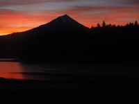
Sunrise behind Mt. Mcloughlin
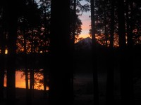
Again
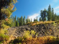
Pine forests punctuated by lava flows
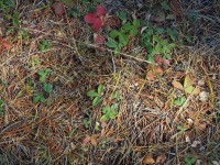
We really should know this by now but... posion oak/ivy? need to look up.
Just finished lunch
Pine forests
The road down to Ashland.
(A tad early, but) Welcome to California.!!!
Thanks Mom!